


THE BEADSWORTH FAMILY: PHOTOGRAPHS, MAPS AND SUPPLEMENTAL ITEMS
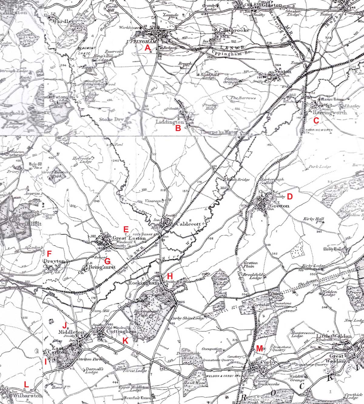
The map shows many of the places mentioned in the story of the 19th century Beadsworth and associated families. The three counties meet in the middle of the upper third of the map: Northamptonshire lying to the south of the River Welland; Leicestershire and Rutland to the the north. The Ire Brook marks the boundary between the latter two. The close proximity of villages in different counties can be appreciated by reference to Gretton (Northamptonshire), Great Easton (Leicestershire) and Caldecott (Rutland)
CLOSE WINDOW TO RETURN TO THE ARTICLE
KEY: A: The Church of St Peter & St Paul; B: The Beast Market; C: Uppingham School; D: Rope Walk; E: Bullock's / Hope's Yard
CLOSE WINDOW TO RETURN TO THE ARTICLE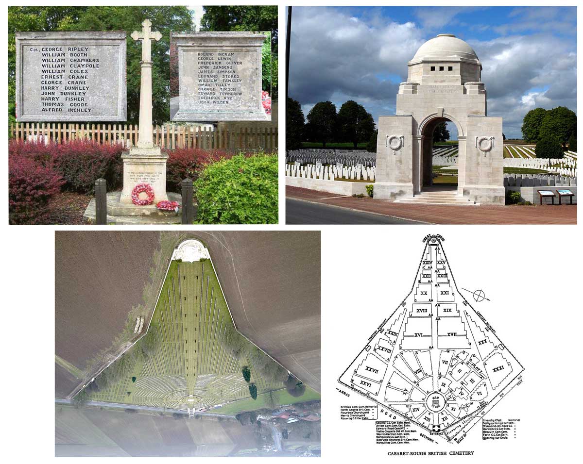
UPPER LEFT: The War Memorial, Cottingham; George Thomas Goode's Name appears on the inset panel on the right
UPPER RIGHT: The Grand Arch; Cabaret-Rouge British Cemetery, Souchez, France (1)
LOWER LEFT: Aerial view of the Cabaret-Rouge British Cemetery (2)
LOWER RIGHT: Cemetery Map; George is buried in Section VIII Row O Grave 5 (3)
References for this image:
1. Image of the Cabaret Rouge British Cemetery © Osioni released into the public domain via Wikimedia Commons
2. A view of the cemetery from a drone: by John Stokes in Cabaret-Rouge British Cemetery Rutland Remembers
3. CWGC Map CRAVEN'S Part In The GREAT WAR
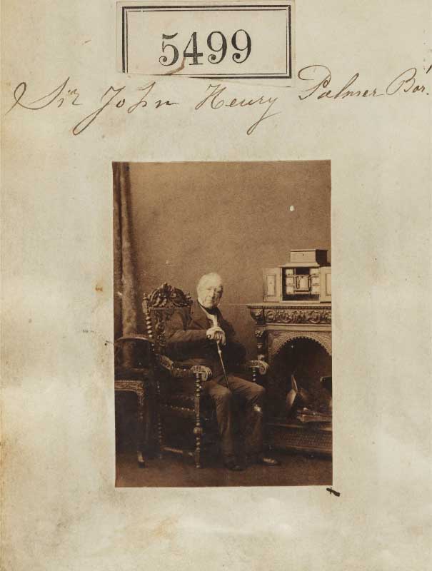
Portrait of Sir John Henry Palmer, 7th Bt albumen print by Carmille Silvy: August 14th 1861. The Photographic Collection The National Portrait Gallery Ax55458. Reproduced with permission under this Creative Commons Attribution-NonCommerciazl-NoDerivs 3.0 Licence
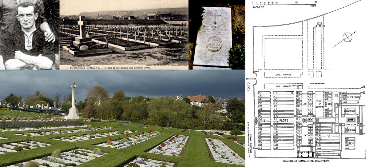
UPPER LEFT: Arthur Beadsworth in Leicester Fosse strip (1)
UPPER CENTRE: The cemetery in 1919 (2)
UPPER RIGHT: Arthur Beadsworth CWGC headstone (1)
LOWER LEFT: Wimereux Communal Cemetery general view (3)
LOWER RIGHT: Cemetery Map; Arthur is buried in Section VI Row C Grave 19 (4)
Note that the headstones are laid in rows flat. This cemetery is also the final resting place of Canadian Lieutenant Colonel John McRae who wrote the poem "In Flanders fields the poppies blow".
References for this image:
1. Photographs of Arthur Beadsworth and of the headstone © and courtesy of Hinckley & District Museum, Reproduced with permission
2. Wimereux Cemetery about 1919: from an old postcard at WW1Cemeteries.com
3. Photograph of Wimereux Communal Cemetery by Anne-Sophie Flament in Remembrance Trails of the Great War in Northern France
4. Cemetery map in Wimereux Communal Cemetery CRAVEN'S Part In The GREAT WAR
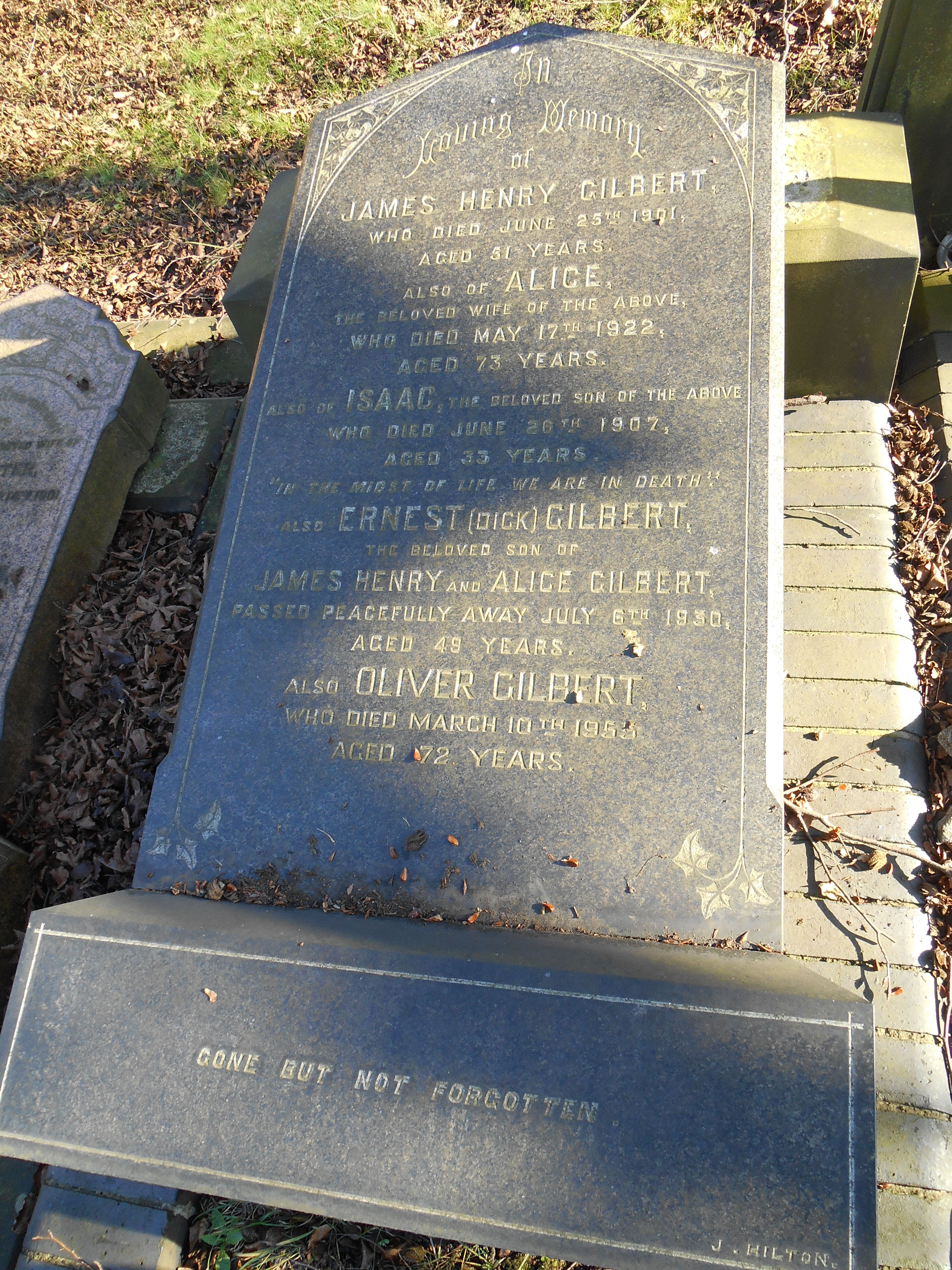
In
Loving Memory
Of
JAMES HENRY GILBERT
who died June 25th 1901
Aged 51 years
Also of ALICE
The beloved wife of the above
Who died May 17th 1922
Aged 73 years
Also of ISAAC, the beloved son of the above
Who died June 20th 1907
Aged 33 years
"In the midst of life we are in death"
Also ERNEST (DICK) GILBERT
The beloved son of
JAMES HENRY and ALICE GILBERT
Passed away peacefully July 8th 1930
Aged 49 years
Also OLIVER GILBERT
Who died March 10th 1953
Aged 72 years
Gone but not forgotten
Photograph by Jackie Marsh: Gilbert Family HeadstoneSection M Plot 807 Friends of Welford Road Cemetery, Leicester. at Find A Grave: Reproduced with permission
The Clock Tower (not annotated) is in the junction between High Street, Humberstone Gate and Gallowtree Gate.
CLOSE WINDOW TO RETURN TO THE ARTICLE
In Loving Memory Of
JAMES RILEY
who died March 23rd 1908
Aged 54
Also
SARAH
Wife of the above
Who died May 21st 1926
Aged 76
Also
In Loving Memory Of
FRANCES BEADSWORTH
Daughter of the above
And Beloved Wife of
ALBERT
Who died July 22nd 1931
Aged 51
"Some Day We'll Understand"
Photograph by Jackie Marsh: Riley Family MonumentSection D Plot 37 Friends of Welford Road Cemetery, Leicester. at Find A Grave: Reproduced with permission


Ypres (now Ieper) is a town in the Province of West Flanders. The Memorial is situated at the eastern side of the town on the road to Menin (Menen) and Courtrai (Kortrijk).
The Menin Gate is one of four memorials to the missing in Belgian Flanders which cover the area known as the Ypres Salient. Broadly speaking, the Salient stretched from Langemarck in the north to the northern edge in Ploegsteert Wood in the south, but it varied in area and shape throughout the war. The Salient was formed during the First Battle of Ypres in October and November 1914, when a small British Expeditionary Force succeeded in securing the town before the onset of winter, pushing the German forces back to the Passchendaele Ridge. The Second Battle of Ypres began in April 1915 when the Germans released poison gas into the Allied lines north of Ypres. This was the first time gas had been used by either side and the violence of the attack forced an Allied withdrawal and a shortening of the line of defence. There was little more significant activity on this front until 1917, when in the Third Battle of Ypres an offensive was mounted by Commonwealth forces to divert German attention from a weakened French front further south. The initial attempt in June to dislodge the Germans from the Messines Ridge was a complete success, but the main assault north-eastward, which began at the end of July, quickly became a dogged struggle against determined opposition and the rapidly deteriorating weather. The campaign finally came to a close in November with the capture of Passchendaele.
The YPRES (MENIN GATE) MEMORIAL now bears the names of more than 54,000 officers and men whose graves are not known. The memorial, designed by Sir Reginald Blomfield with sculpture by Sir William Reid-Dick, was unveiled by Lord Plumer in July 1927.

In
Loving Memory
Of
JOHN HENRY GILL HEADLEY
who died December 12th 1903
Aged 49 years
Also of
His beloved wife MARY HEADLEY
Died 29th Aug 1932
Aged 77 years
Reunited
Also of
ALBERT EDWARD
Son of the above
Who died July 14th 1908
Aged 11 years
"Not our will O Lord but thine be done"
Also of
ANNIE
Their beloved daughter
Who died 31st Jany 1945
Aged 67 years
Also of
WILLIAM HEADLEYT
Who died 30th July 1962
Aged 73 years
R.I.P.
Photograph by Jackie Marsh: Headley Family HeadstoneSection M Plot 822 Friends of Welford Road Cemetery, Leicester. at Find A Grave: Reproduced with permission

TOP: LEFT: Headley's Cart; RIGHT: A later view of 33 Andrewes Street (1)
BOTTOM: LEFT: The bakers (John Henry Gill Headley is standing back left); RIGHT: Headley's bread wins prizes (2)
REFERENCES:
1. Andrewes Street 33 - 55, 1971: © Dennis Calow. They appear in the section "Vanished Leicester" in the My Leicestershire History website and are reproduced here under the terms of this Creative Commons Licence.
2. Announcing prize wins for bread in 1899: Leicester Daily Post Page 1 March 22nd 1900 The British Newspaper Archive; © The British Library Board.

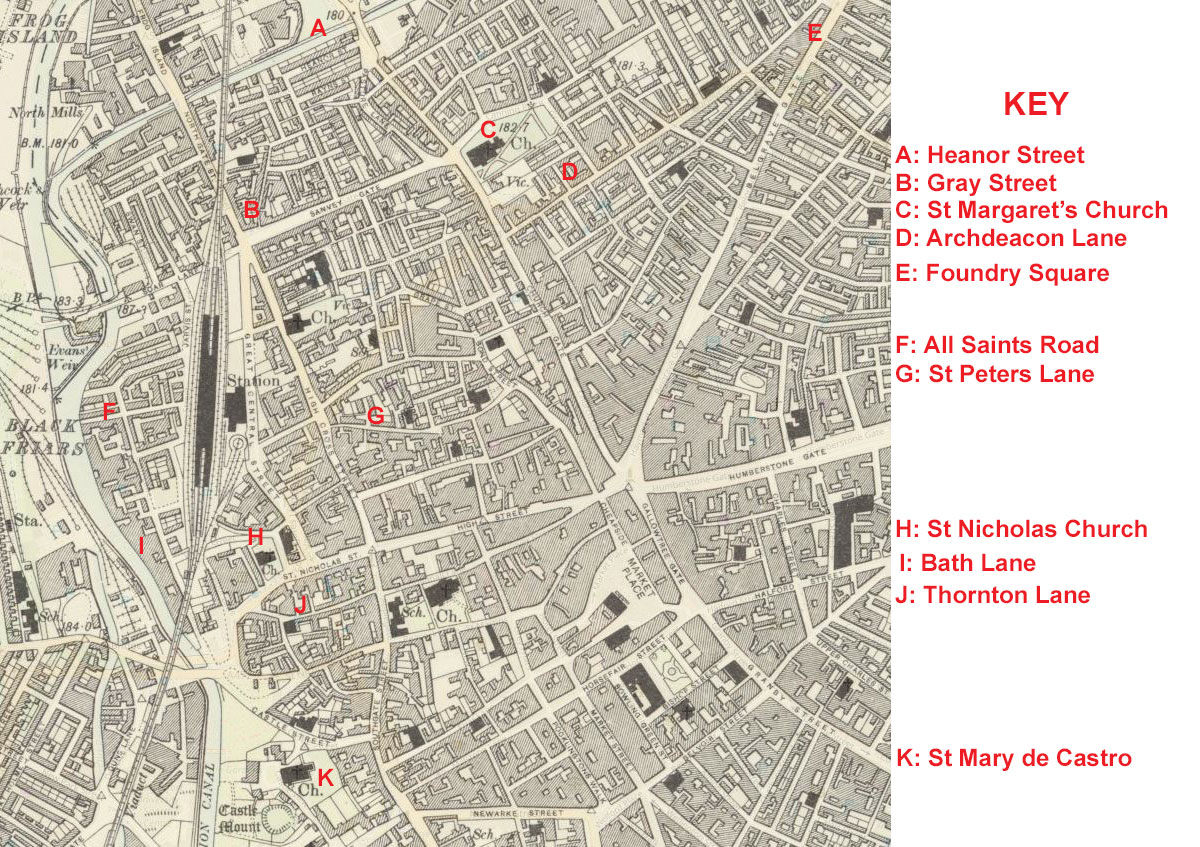
Streets mentioned in relation to the families of Joseph and Mary Ann Beadsworth and John Henry and Polly Headley
CLOSE WINDOW TO RETURN TO THE ARTICLE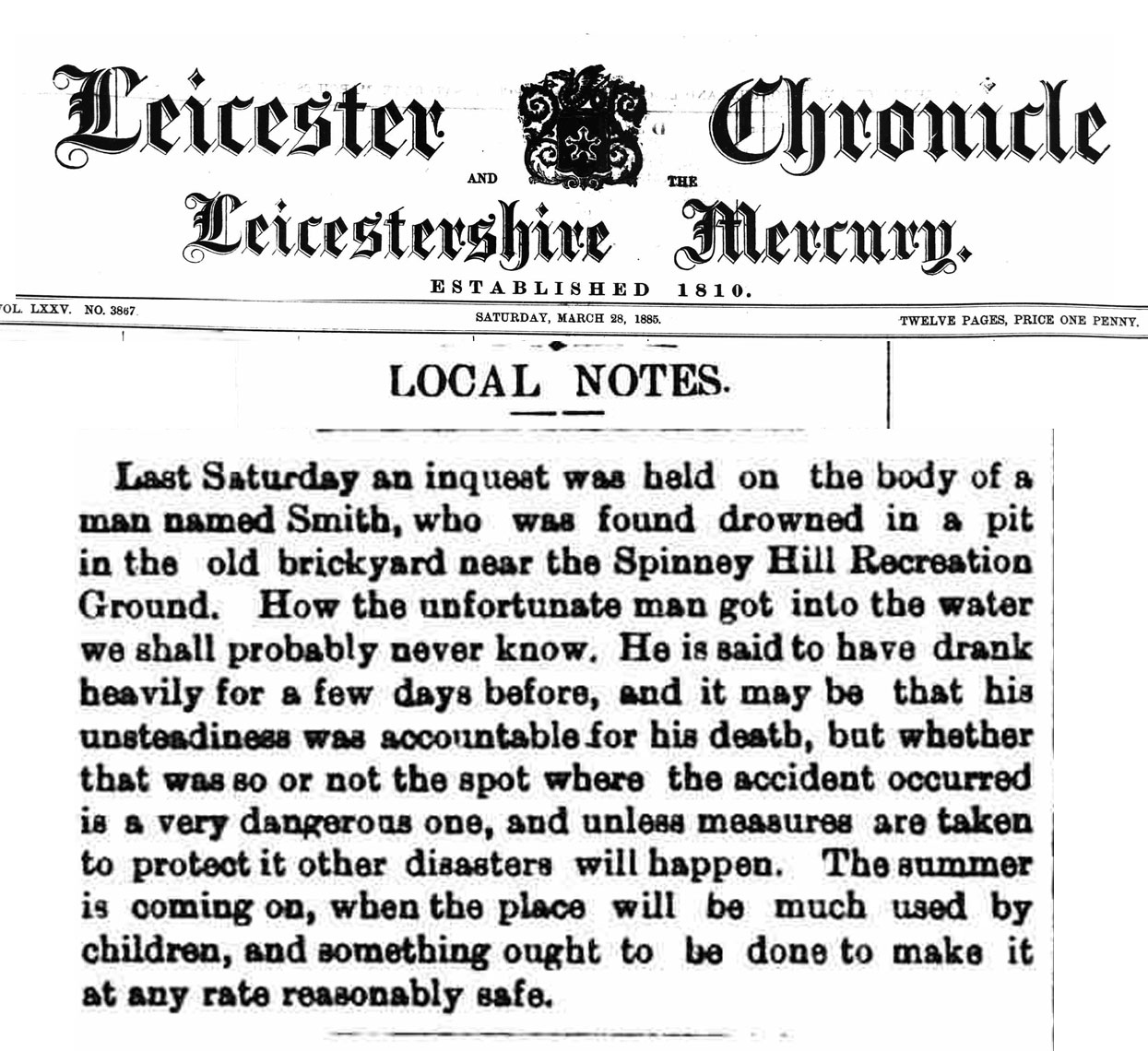
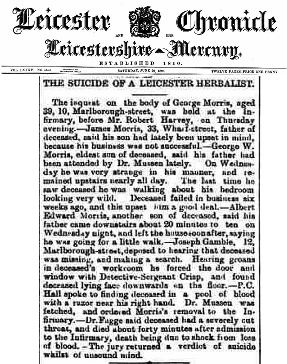
Left: Frank Smith Inquest, March 22nd 1885; Right: George Morris Inquest June 20th 1896
Frank Smith was the husband of Jane Binley; George Morris was the husband of Charlotte Binley. Jane and Charlotte were sisters
George Morris was the husband of Charlotte Binley
CLOSE WINDOW TO RETURN TO THE ARTICLE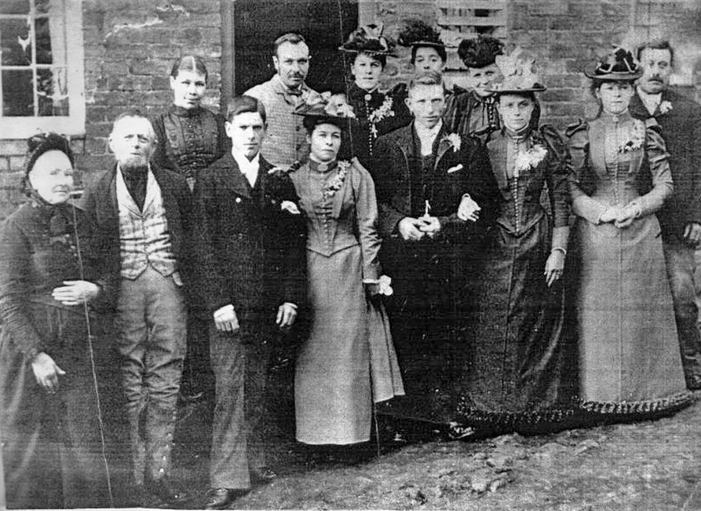
Front left: Sarah Charlotte Wingell; her husband Charles Robert Binley; Charles Robert was the son of Thomas Binley and Mary Reynolds. Jeffrey and Lewis Binley were his brothers
Front centre: George Binley; Elizabeth Ann Bradshaw (with linked arms)
Rear: (behind Charles Robert) Fanny Bull
Photograph taken outside John Bradshaw's cottage in Barrack Yard on February 16th 1893
CLOSE WINDOW TO RETURN TO THE ARTICLE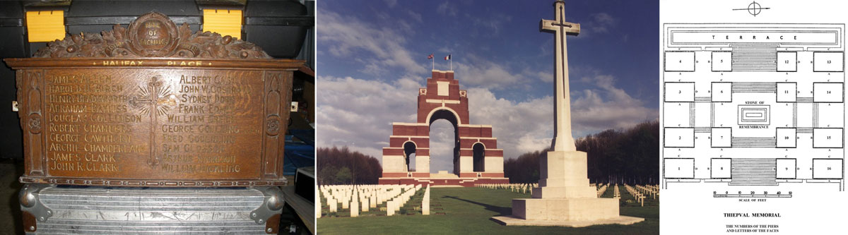
LEFT: Halifax Place Weslayan Chapel War Memorial; RIGHT: Thriepval Memorial and site map
Photograph A-H by Rachel Farrand of Halifax Place Wesleyan Chapel War Memorial Roll of Honour Nottingham City Council
On 1 July 1916, supported by a French attack to the south, thirteen divisions of Commonwealth forces launched an offensive on a line from north of Gommecourt to Maricourt. Despite a preliminary bombardment lasting seven days, the German defences were barely touched and the attack met unexpectedly fierce resistance. Losses were catastrophic and with only minimal advances on the southern flank, the initial attack was a failure. In the following weeks, huge resources of manpower and equipment were deployed in an attempt to exploit the modest successes of the first day. However, the German Army resisted tenaciously and repeated attacks and counter attacks meant a major battle for every village, copse and farmhouse gained. At the end of September, Thiepval was finally captured. The village had been an original objective of 1 July. The Memorial can be found off the main Bapaume to Albert road (D929). It bears the names of more than 72,000 officers and men of the United Kingdom and South African forces who died in the Somme sector before 20 March 1918 and have no known grave. Over 90% of those commemorated died between July and November 1916. The memorial, designed by Sir Edwin Lutyens, was built between 1928 and 1932 and unveiled by the Prince of Wales, in the presence of the President of France, on 31 July 1932. Each year a major ceremony is held at the memorial on 1 July. © Commonwealth War Graves Commission
CLOSE WINDOW TO RETURN TO THE ARTICLE
Pozieres is a village 6 kilometres north-east of the town of Albert. The Memorial encloses Pozieres British Cemetery which is a little south-west of the village on the north side of the main road, D929, from Albert to Pozieres. On the road frontage is an open arcade terminated by small buildings and broken in the middle by the entrance and gates. Along the sides and the back, stone tablets are fixed in the stone rubble walls bearing the names of the dead grouped under their Regiments.
CLOSE WINDOW TO RETURN TO THE ARTICLE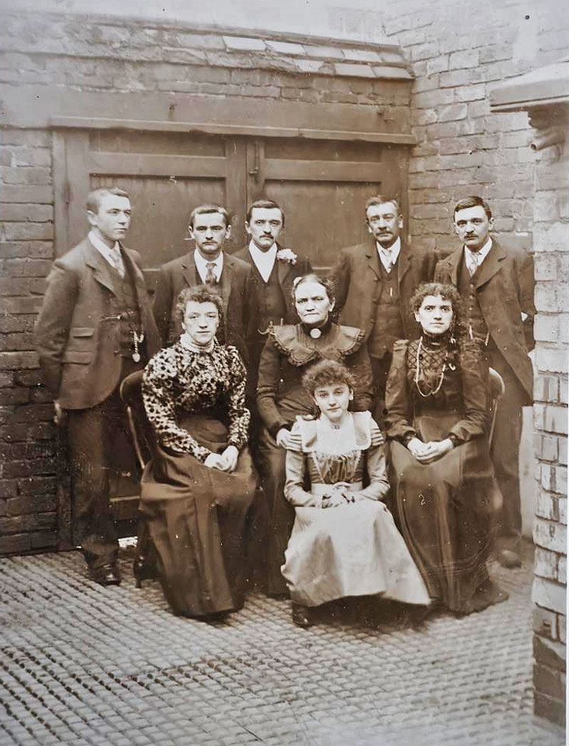
BACK ROW: Oliver; Ernest (Dick); Isaac; James Henry (father); James Arthur
MIDDLE: Rose; Alice (mother); Alice (daughter)
FRONT: Kate
This photograph was taken in the yard of the Black Horse public house in Foxon Street, Braunstone Gate and is thought to be taken on the occasion of son James Arthur's marriage to Alice Spiers in April 1896.
Photograph © Roger Buxton: All rights reserved.
CLOSE WINDOW TO RETURN TO THE ARTICLE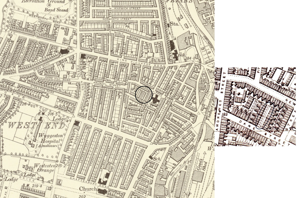
CLOSE WINDOW TO RETURN TO THE ARTICLE
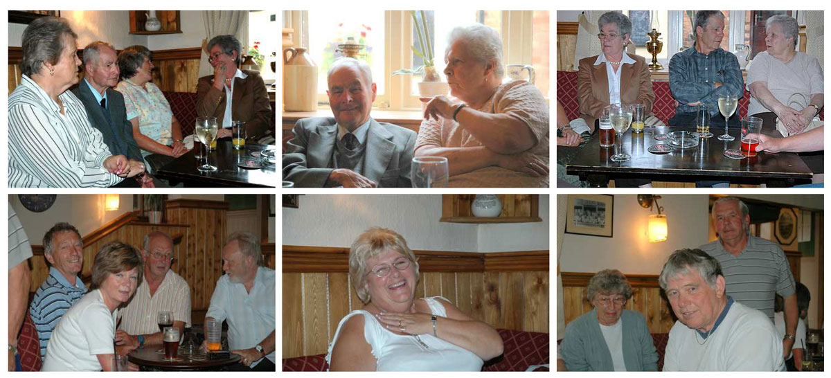
Key to the photographs:
Top Left: Margaret O'Grady (daughter of Hilda Beadsworth); Albert Beadsworth; Margaret Crane (Donald's wife); Sheila Walsh
Top Middle: Albert and Hilda Beadsworth
Top Right: Sheila Walsh (daughter of Connie Beadsworth); Donald Crane (son of Eva Beadsworth); Hilda Beadsworth
Bottom Left: FRONT: Mary Needham (Laurie's sister);REAR L to R: Laurie Beadsworth (son of Fred);
Norman Needham (Mary's husband); Mike O'Grady (Margaret's husband)
Bottom Middle: Irene Beadsworth (Laurie's wife)
Bottom Right: FRONT:Norman Beadsworth (Cecil's son); REAR: Kath Crane (Tony's wife); Tony Crane (son of Eva Beadsworth)
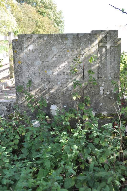
In loving memory of
Our dear parents
LOUISA BEADSWORTH
Who died June 11th 1920
Aged 43 years
ARTHUR BEADSWORTH
Who died February 22nd 1947
Aged 71 years
Reunited
Photograph: Plot 34 Row B2 St Mary Magdalene churchyard, Cottingham, Northamptonshire
CLOSE WINDOW TO RETURN TO THE ARTICLE
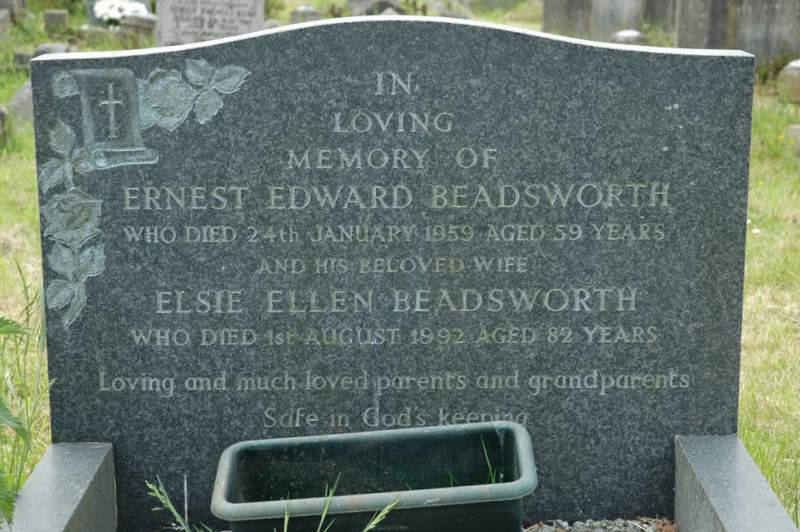
In
Loving
Memory of
ERNEST EDWARD BEADSWORTH
Who died 24th January 1959 Aged 59 years
And his beloved wife
ELSIE ELLEN BEADSWORTH
Who died 1st August 1992 Aged 82 years
Loving and much loved parents and grandparents
Safe in God's keeping
Photograph: Plot 117 Row G11 St Mary Magdalene churchyard, Cottingham, Northamptonshire
CLOSE WINDOW TO RETURN TO THE ARTICLE
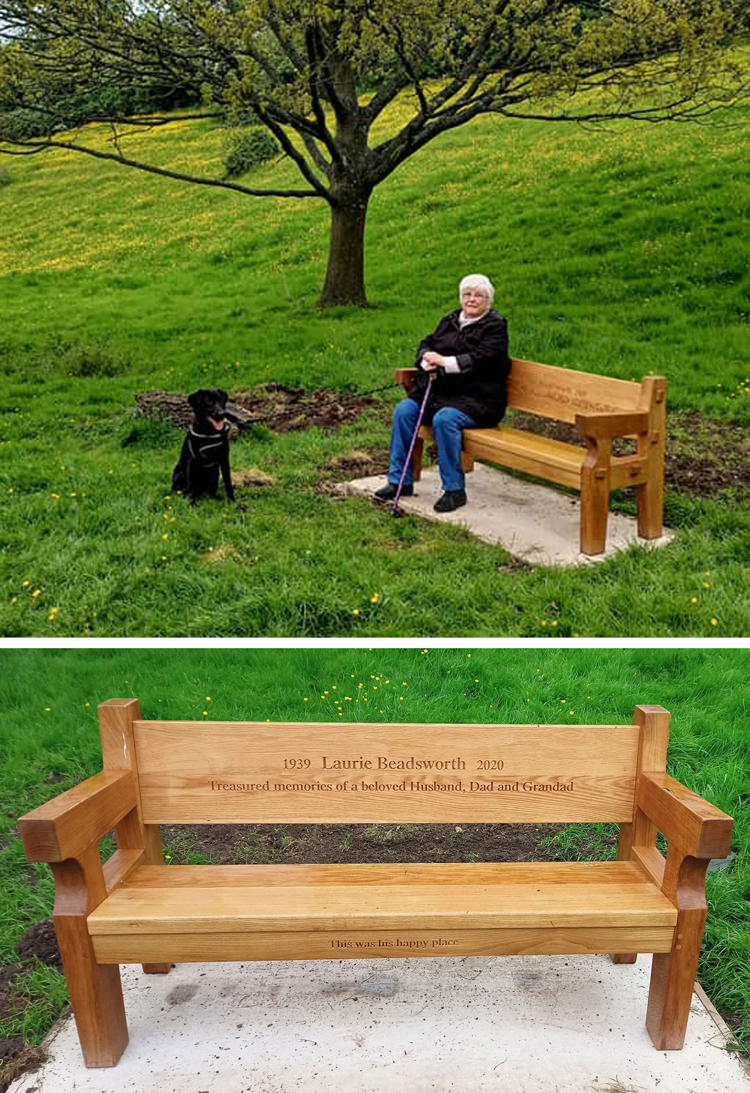
The bench is situated in The Dale, Laurie's favourite place, which lies on the south side of the village behind St Mary Magdalene Church. Seated on the bench is Irene, Laurie's widow.
Photograph courtesy of Sally Shannon nee Beadsworth, Laurie and Irene's youngest daughter.
CLOSE WINDOW TO RETURN TO THE ARTICLEAdded: August 1st 2020
Last updated May 17th 2023
Translate this page:


Internet Beacon Diamond Site - 2010
© The Craxford Family Genealogy Magazine and individual copyright holders.Edited and maintained by Alan D. Craxford 2005 - 2026. All rights reserved. Contents may not be reproduced without permission.
You are not authorized to add this page or any images from this page to Ancestry.com (or its subsidiaries) or other fee-paying sites without our express permission and then, if given, only by including our copyright and a URL link to the web site.