


![{$text['mgr_red1']}](../tng_placered.jpg) Gretton 1
Gretton 1
Page 3d. Gretton and its people
Is this where it all began?

Alan Craxford Site Administrator
The name Craxford first appears in the available records in the opening decades of the seventeenth century. The earliest three sighting occurred in Thornton, Buckingham; Dallington, Northampton and here in Gretton, Northamptonshire (discussed here in the article Who is the Craxford edler statesman?). These are references to adults bearing that name which when extrapolated back to a birth year reach about 1620. Although to date it has been impossible to prove, the most likely assumption is that the name is a bastardisation of the name Croxford. If this is the case the line could be connected with families in Buckinghamshire and Oxfordshire.

The village of Gretton lies in the floor of the Welland Valley on the northern edge of the County of Northampton some three miles to the east of Rockingham Castle. The name is Saxon for Great Settlement although much earlier traces of Iron-Age and Roman excavations have been found. It was a royal manor during the 11th century, the same period in which St James the Great Church was built. It became an important settlement within Rockingham Forest during the Middle Ages, and its development and economy were founded on the twin occupations of agriculture and ironstone quarrying.
We have been able to trace the Craxford dynasty from this local beginning and it is no mean boast that we are able to place virtually every bearer of the surname in their proper place on the greater family tree. Elements of the Craxford family were present in Gretton for 300 years. In the main their experiences were typical of life in rural England wrestling the onslaught of poverty, disease and political and social change. They were agricultural labourers or journeyman employees who did not rise to great heights or achieve great wealth. Many left their village existence to seek a better life in the nearby towns or joined the exodus overseas. We do know of one worthy in the village who became a yeoman and of his son who owned a smallholding.

Harringworth Viaduct crossing the Welland Valley (1)
The village and its inhabitants saw great upheaval to their way of life in the 1870s with the coming of the railway. Work started on a line from Manton just south of Oakham in Rutland to Kettering which would connect two different systems; the Midland Main Line which ran from London to Sheffield and the line from Birmingham to Peterborough. Over 3000 people from near and far toiled on the project. In the short space of thirteen miles the line traversed embankments, cuttings and tunnels. Although now serving only freight traffic and the occasional steam excursions, it has left a dramatic legacy on the landscape in the 82 arch Harringworth Viaduct which crosses the Welland Valley. One of the line's four stations was at Gretton

The author at Craxford Road
There are no Craxfords left in the village now. However the family has left a lasting legacy for all to see. For whom the accolade was decreed and when, we do not know (it may have been in respect of the yeoman or his son), but by the time of the England census of 1891 one of the village's byways became known as Craxford Lane. In more recent times this has been upgraded to Craxford Road - a name which persists to this day. On a more personal level, there is a modest detached dwelling in the village called 'Craxford House' so named by the original occupant because both his grandmothers were Craxfords (first cousins) by birth.

Craxford House
The geography of Gretton is not easy to follow from most of the Victorian records as most dwellings in the village were merely entered as "Gretton" with an enumerator's index number. Where names were given to the byways historically, most have disappeared being absorbed into the modern nomenclature. The lane which ran along the eastern side of the village known as Back Side is now Kirby Road. Gretton's High Street now passes through the centre of the village joining Kirby Road to the north and south. Previously its upper end were Sanctuary End and North Street and its lower end Workhouse Lane. The Gap became School Lane. Pound Lane and The Nook are now The Maltings, while Town's End and Little London have become Arnhill Road. With the coming of the railway, Stoney Lane was renamed Station Road. As well as Craxford Lane (now Road), several other streets were named after local worthy families including Spendlove Drive and Stafford Road. Some places, such as Satchell's Yard and Old Chapel Yard were descriptive but have disappeared. The origin of some of these names, such as Evenhoe Quarter, remain lost in antiquity.
A Welland Valley Roll Call
Over time, as our investigations have proceeded, we have come to realise that no one family can be meaningfully studied in isolation. Trees touch and branch, join and rejoin, across the generations through marriage and new birth. The interrelationships between individuals can only be fully appreciated when surnames are traced between cousins and along female lines. This is particularly true when the families belong to a small community such as a village.
We have been fortunate that, for Gretton at least, records are available for study going back to 1620. In this section, we repeatedly come across the same few surnames, albeit with changes of spelling over the centuries. Some date back to the earliest records. The first Craxford appears to have arrived in the village about that time, probably as a corruption of the surname Croxford. We have included the villages of Barrowden and Lyddington over the border in Rutland here as they were important 'emigration points'. The chart below lists the most common.
Local web sites of interest
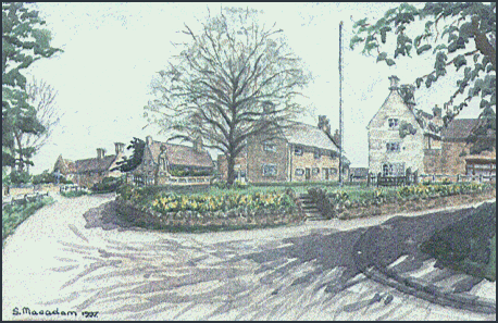

The front page of this site leads to four other sections including a fully illustrated guide to the village of Gretton in Northamptonshire edited by
Maurice Kellner. The illustration above is "The Green, Gretton", from an original watercolour by Sheila Macadam © 1998. The Gretton Local History Society site supervised by Elisabeth Jordan. She has been very helpful on a number of occasions in
pointing out directions of research and study into the family name.
Alan D. Craxford - Site Administrator
A village gallery
The centrepoint of the village is the Church of St James the Great, a building which was started in the 11th century. Its most notable feature is the oddly shaped east window, narrowing down towards its base, which overlooks the graveyard. The church lies opposite to The Green on which sits the village War Memorial. It is also the site of one of the last remaining village stocks and whipping post in the country, last used as punishment over 150 years ago.

St James the Great Church, Gretton

St James the Great Church, the nave and altar

St James the Great Church, the East window and churchyard

The War Memorial

The Village Green (2)

The Stocks

Stoneleigh House: long time property of the Myers family (3)

The Post Office, High Street

The Old Workhouse
Please contact us
 If you have any questions or comments about the information on this site in general, or you have further information regarding this article, please Get in touch by leaving a message in our Guestbook. If you don't want the message to be added to the Guestbook, just say that in your text. We look forward to hearing from you.
Gretton Stories
 CRAXFORD LANE: A GENEALOGY
No-one is quite sure when Craxford Lane was first so called and it is also not clear when the Lane was promoted to its current status as Craxford Road. Similarly no-one is also quite sure why the family were so honoured.
 FROM GRETTON TO BARROWDEN 1: THE SKIN TRADE
The story of three brothers and their involvement in an unexpected occupation
 FROM GRETTON TO BARROWDEN 2: FROM CRAXFORD TO WAINWRIGHT AND BEYOND
Following the the lives and times of the offspring of Robert Craxford, fellmonger
THE GRETTON CRAXFORDS: CHRONICLES I - THE TANGLED TREES
While standing beside an unguarded fire John Robert's clothes caught alight. A neighbour alerted by his screams managed to put out the flames. He was taken to the Royal Infirmary but died the following morning.
 THE GRETTON CRAXFORDS: CHRONICLES II - CAROLINE AND ENOS
It is not known how or where Caroline met her future husband, Enos Jackson, or why she left her employment in Rutland. They were married in Louth, Lincolnshire on May 20th 1873.
 THE CROXTON CONUNDRUM AND OTHER MYSTERIES: THE POLLARD GIRLS
Things took a dramatic and terrible turn for the worse at the beginning of the new year. Joseph Foreman had been living with Matilda now for nearly three years ...
 CRAXFORD: IN GRETTON AND BEYOND
It appears that William suffered from a stroke in the summer of 1881. He died aged 31 years. After his death all three sons spent time at the London Orphan Asylum.
 MRS EVELYN CRAXFORD
"She was certainly the most outstanding lady bowler at Southgate at that time"
 THE GRETTON CRAXFORDS: EXODUS II - ALL SORTS OF LIQUORISH
The cause of death entered on the death certificate was "atrophy". This indicates a general wasting disease, probably due to a relative starvation through inadequte breast feeding or lack of satisfactory alternatives. A son, John, was six months old when he died in 1855. "Atrophy" was again given as the cause of death.
The Gallery (continued)
The census of 1881 lists six public houses so that the villagers were only ever a few steps away from their refreshment. The Fox (closed in 1970) and the White Hart (closed in the 1930s) both stood close to the Village Green. The White Hart became the Gretton Stores and now sports a tea shop. The Talbot sits at the junction of the High Street and Arnhill Road and has been a pub for over 150 years. The Hatton Arms at the north end of Craxford Road is the oldest hostelry in the village (and reputedly the second oldest in the county). Its name goes back to Christopher Hatton, a governor of a castle in Guernesey, in the 17th century. Tradition has it that as a reward for valiantly savings members of the family from a huge explosion, one of the servants, a black man named James Chappell, was granted a pension and became the landlord of the pub.

The Hatton Arms (4)

The Baptist Chapel
A nonconformist tradition began in Gretton in the late 18th century. The Baptist Church, which stands to the south end of the High Street, was consecrated in 1824. The Old School House, built in 1853 to the east of St James the Great Church and opposite the Village Green served the educational needs of the children of the village until 1908. It was replaced by a new building on Kirby Road which has places for over 100 pupils.

Houses
A walk around the village

An illustrated guide to the sites and history of Gretton
This booklet, prepared by the Rockingham Forest Trust, provides a walking tour of Gretton with two maps and 27 points of interest.
References
1. Harringworth Viaduct Walk The Wellingborough and Kettering Over 40's Social Group
2. Photograph: Gretton Village Green by Asktheratas [Public domain] via Wikimedia Commons
3. Stoneleigh House, Gretton. Listed Buildings in Gretton, Northamptonshire, England British Listed Buildings Online
4. Hatton Arms: © Tim Heaton, and licenced for reuse under this Creative Commons Licence
Page added: November 18th 2015
Last update: October 31st 2021
Return to Top of Page
Translate this page:


Internet Beacon Diamond Site - 2010
© The Craxford Family Genealogy Magazine and individual copyright holders.Edited and maintained by Alan D. Craxford 2005 - 2026. All rights reserved. Contents may not be reproduced without permission.
You are not authorized to add this page or any images from this page to Ancestry.com (or its subsidiaries) or other fee-paying sites without our express permission and then, if given, only by including our copyright and a URL link to the web site.